 |
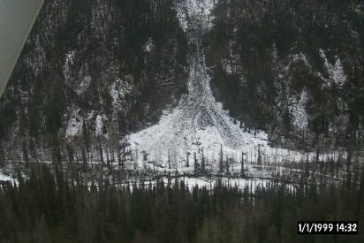
Photo 1 – The well defined McCarthy Creek –
Green Butte Road crosses in front of natural mud flow and slide about
8.5 miles South of Marvelous Millsite and 4 miles from McCarthy.
Date taken is 10/26/03. Date
shown on photo is in error. [245a] |
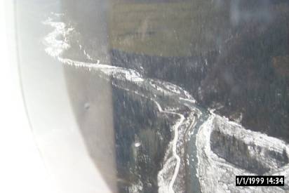 |
Photo 2 – The McCarthy Creek – Green Butte
Road is nearly always very well defined.
Here it is very easy to follow far into the distance.
Date taken is 10/26/03. Date
shown on photo is in error. [252a] |
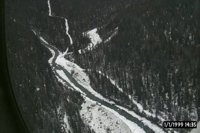 |
Photo 3 – Typical well-defined section of the
McCarthy Creek – Green Butte Road 4 miles south of Marvelous Millsite
at the mouth of the East Fork of McCarthy Creek. Date taken is 10/26/03.
Date shown on photo is in error. [259a] |
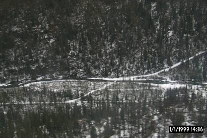 |
Photo 4 – More than one crossing path has been
used in the past at this creek crossing of the McCarthy Creek – Green
Butte Road 3.1 miles south of Marvelous Millsite. Date taken is
10/26/03. Date shown on
photo is in error. [263a] |
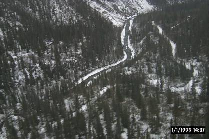 |
Photo 5 – Again, the McCarthy Creek – Green
Butte Road here is very well defined about 1.6 miles south of Marvelous
Millsite and 0.25 miles north of the Green cabin. Date taken is 10/26/03.
Date shown on photo is in error.
[266a] |
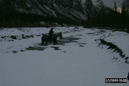 |
Photo 6 – Crossing icy streams is treacherous
for horses which can break through ice, slip on bed rocks, injure or
break legs. Climbing out on
steep, icy banks is also very dangerous.
Even worse with heavy loads or pulling wagons/ sledges. Date
taken is 10/26/03. Date shown on photo is in error.
[270a] |
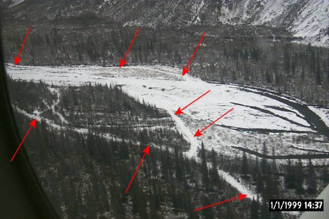 |
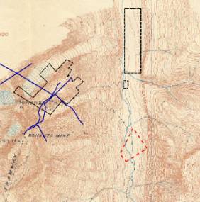
| Photo 7 – Annotated (red arrows) multiple
historic road and trail alternatives are well illustrated here 1 mile
south of Marvelous Millsite. The
1911 USGS topo map showed a trail on the east (far) side of the creek
here while the 1939 topo showed a road on the west (near) side.
Date photo taken is 10/26/03.
[267a] Red
areas on maps below outline coverage of photo above. |
| 1911 USGS topographic map |
1939 USGS topographic map |
 |
 |